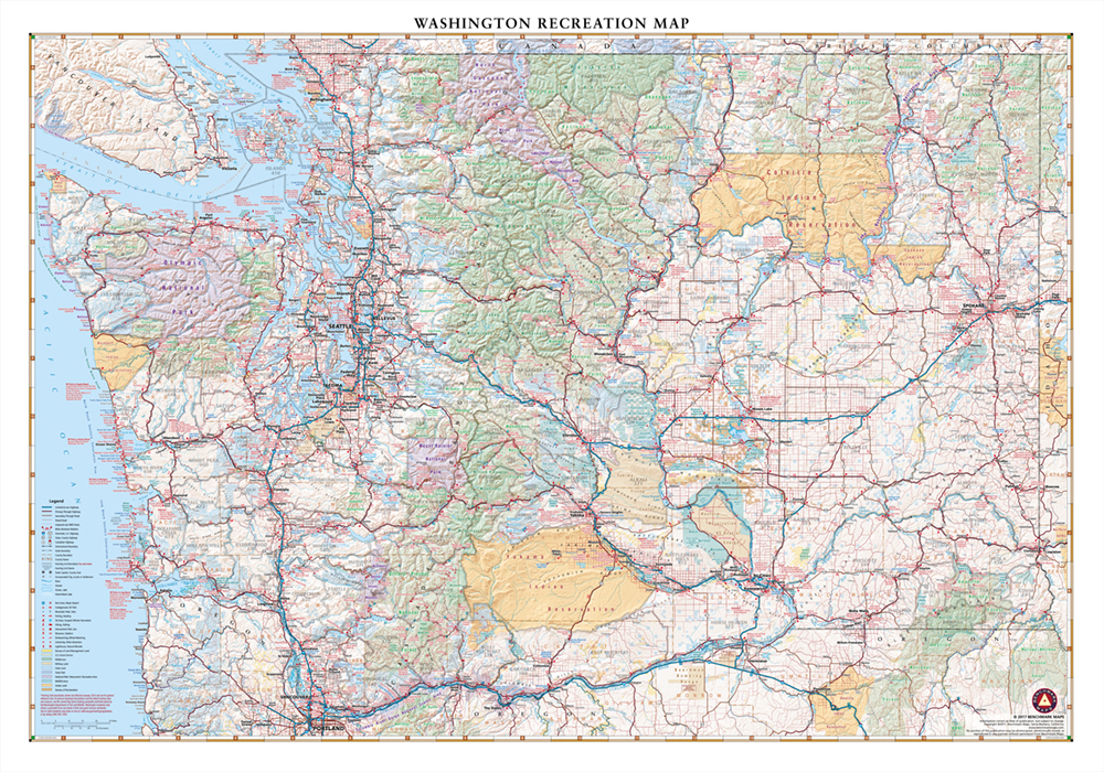
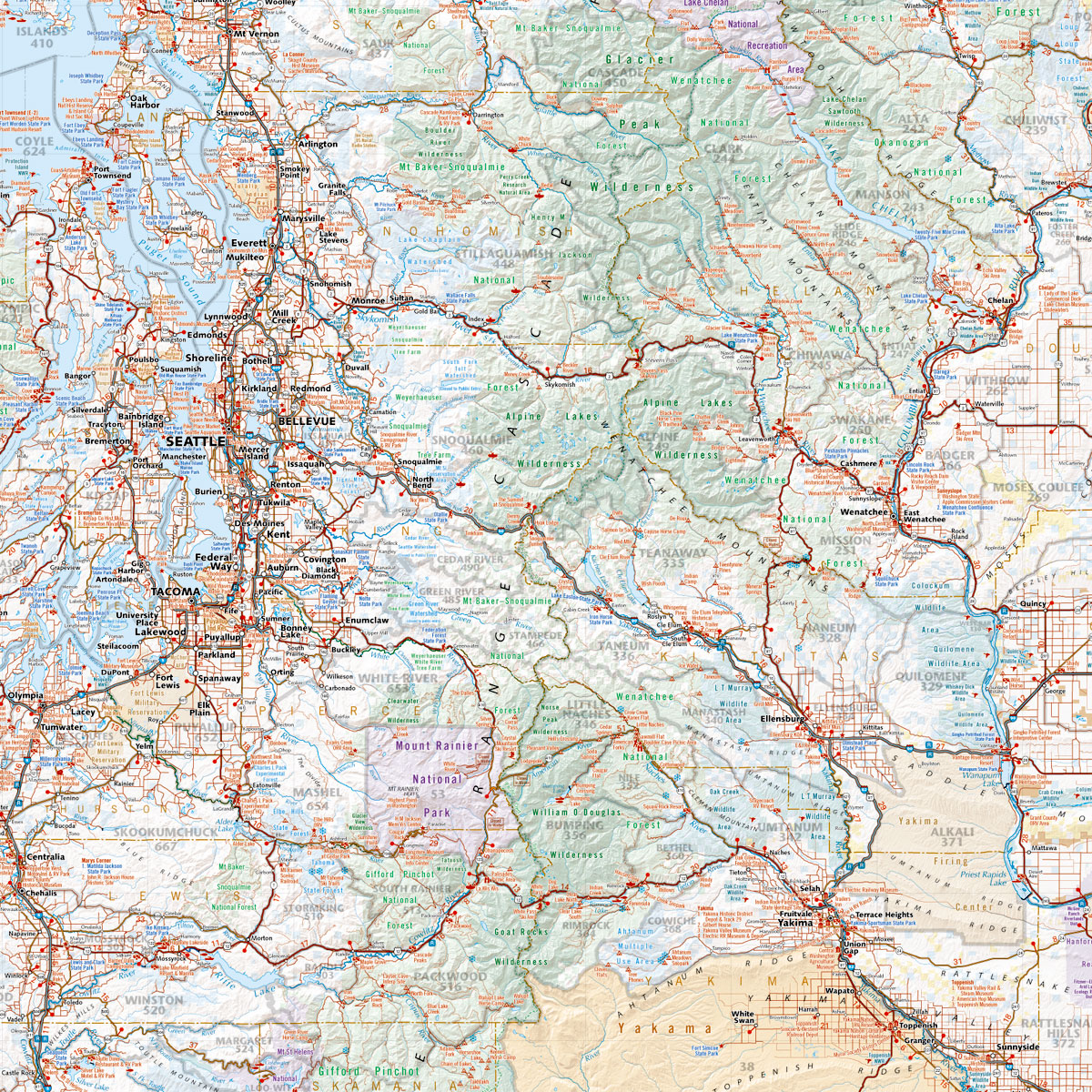
This wall map highlights Washington’s highways, state roads, and recreation opportunities including public lands, parks & monuments, boating & fishing access, hunting unit boundaries, campgrounds, historic sites, and more.
Dimensions: 37″ w x 26″ h
This wall map highlights Washington’s highways, state roads, and recreation opportunities including public lands, parks & monuments, boating & fishing access, hunting unit boundaries, campgrounds, historic sites, and more.
Dimensions: 37″ w x 26″ h
| Weight | 1.5 lbs |
|---|---|
| Dimensions | 49 × 3 × 3 in |


