
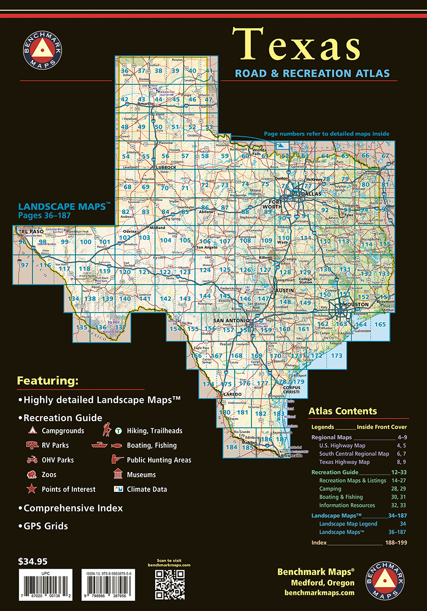
The vast openness of Texas is the source of everything that makes it unique. No other publication can display this dense, expansive landscape and its recreation potential with more precision than Benchmark’s Texas Road & Recreation Atlas. The field-checked Landscape Maps™ reveal back-roads & land-forms with amazing realism and detail, clearly showing how the state’s network of roads and local recreation landmarks fit into the countryside. A Recreation Guide provides regional maps and lists a variety of outdoor activities. Arranged by category, it is the ideal planning tool for any adventure, from a simple day-trip to an extended exploration. Benchmark field-checkers, cartographers, and editors have been working to make the Texas Road & Recreation Atlas the most accurate, comprehensive, and reliable map product ever published for The Lone Star State.
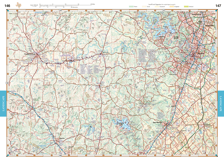
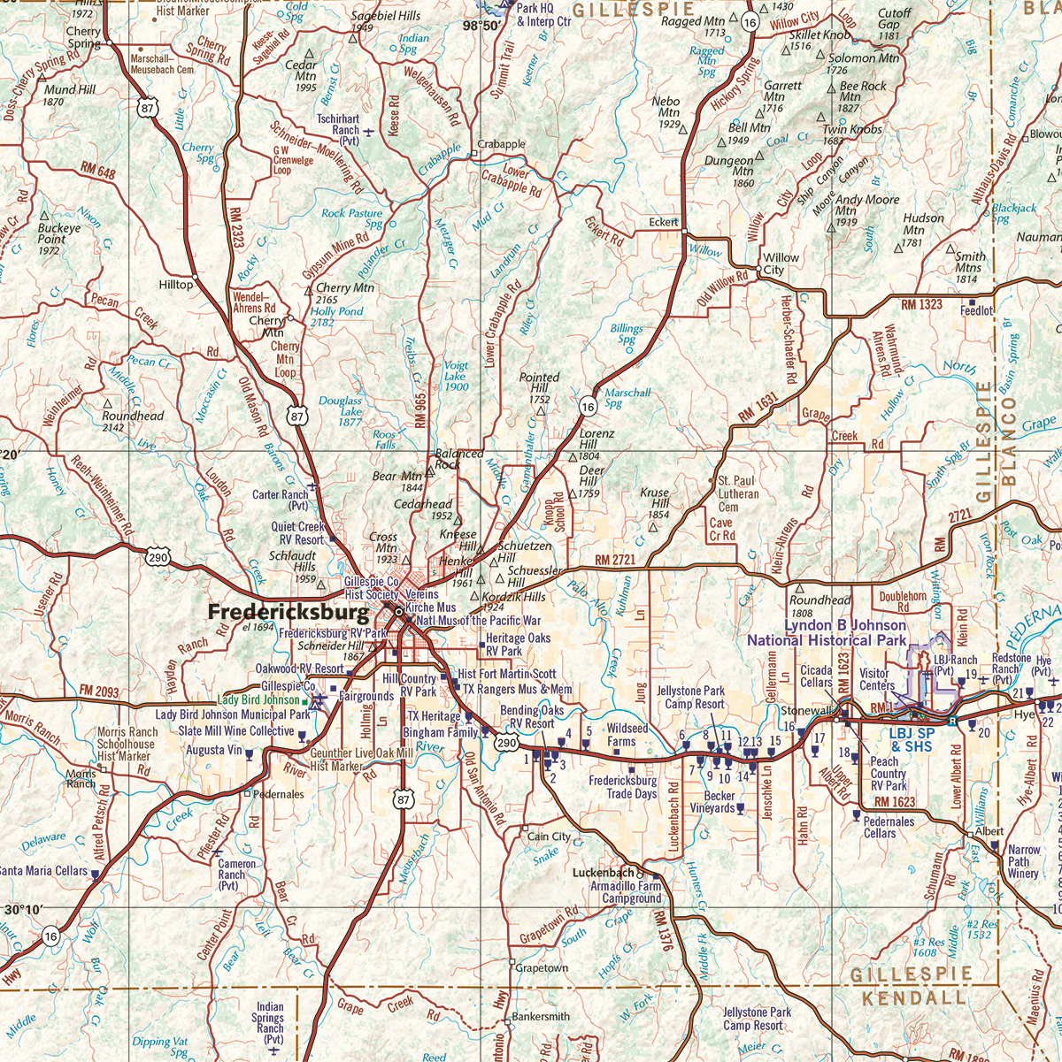
Landscape Maps
- Land cover & vegetation base layer over shaded relief portraying the terrain
- Highway & back-road detail, extensively field-checked
- Many historical markers located & labeled
- Public Lands and Access Points
- Page to page map overlap, superb design
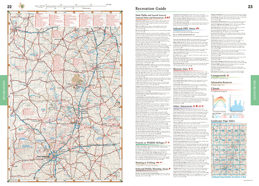
Recreation Guide
- Regional maps with public land detail, recreation points of interest, point-to-point mileages, hunting units, and more
- Categorized listings and map features include: Parks, Monuments, & Wildlife Areas, Camping, Fishing & Boating Access, Museums & Historic Sites, and more.
200 Pages. 3rd Edition, 2025. Spiral-bound; ISBN 9798986387956
Map Scales:
- Landscape Maps 1:253,400 (1″=4 miles)
- Recreation Maps 1:1,267,200 (1″=20 miles)
Benchmark Maps can be found at fine retailers including:
![]()
![]()
![]()
![]()
![]()
![]()


