Shipping class: Wall Maps
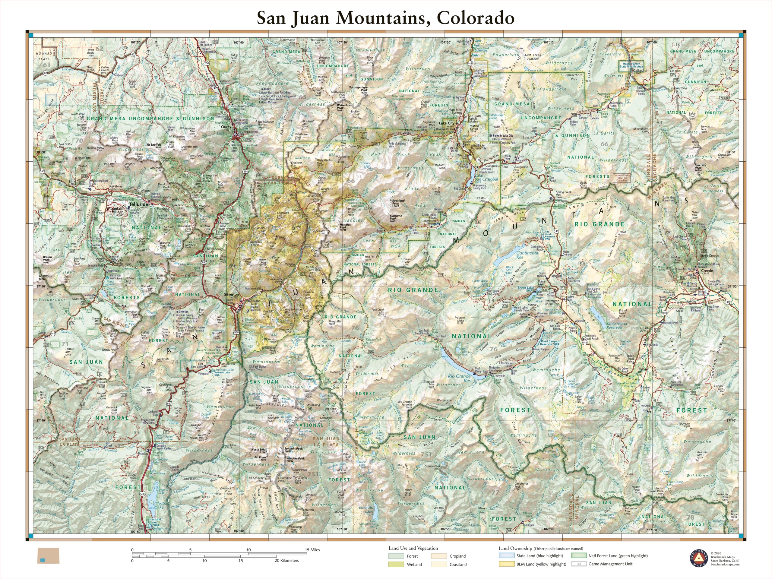
San Juan Mountains, Colorado
—
by
This 40″ x 30″ wall map illustrates the rugged San Juan mountain range in southwestern Colorado. Far removed from Colorado’s bustling Front Range cities, the San Juans host many unique mountain towns including Ouray, Telluride, Silverton, Creede, and Lake City. Map features include public land boundaries, recreation points of interest, and the network of highways…
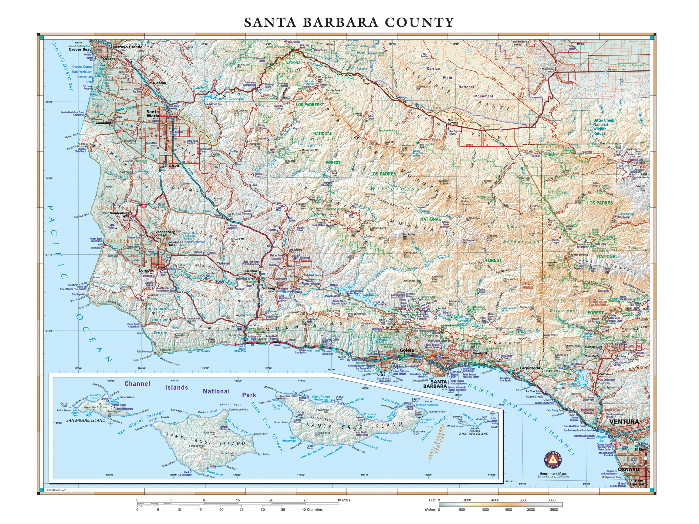
Santa Barbara County Wall Map
—
by
Santa Barbara County is an area of diverse geology and ecology, marking the transition between northern and southern California. Much but not all of the natural coastal area and habitats have been protected from development, save a few ranches. And nearly 25,000 additional acres of pristine California coastline will now be protected indefinitely, thanks…
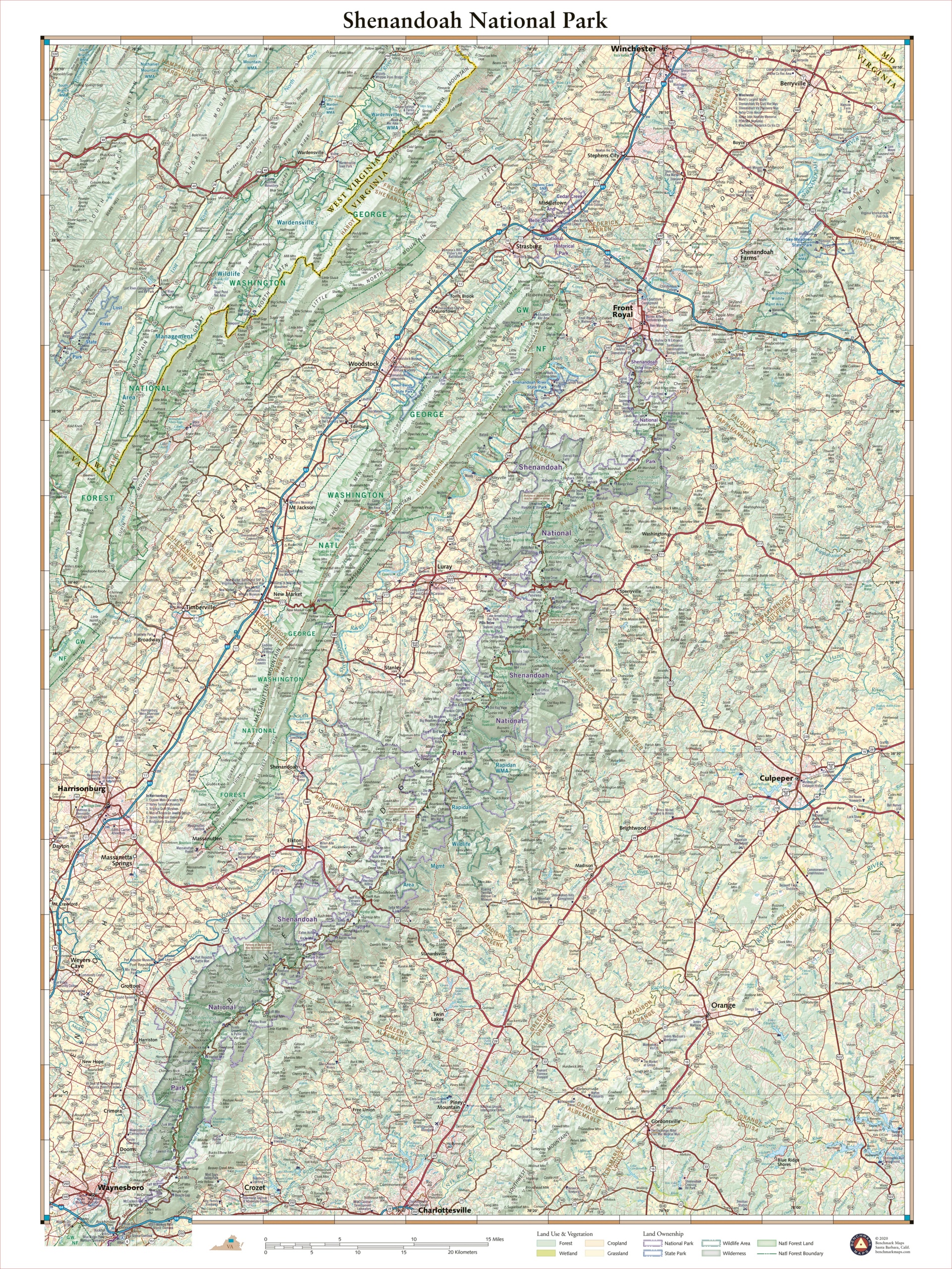
Shenandoah National Park
—
by
Skyline Drive and the Appalachian Trail trace the spine of the Blue Ridge Mountains through this landscape of craggy peaks, deep forests, and rolling ridges. More than a third of the park has been designated as wilderness, providing a welcome escape from nearby cities. This 30″ x 40″ wall map details the terrain and recreation…
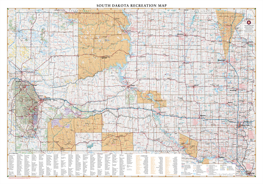
South Dakota Recreation Wall Map
—
by
This wall map highlights South Dakota’s highways, public lands, parks & monuments, boating & fishing access, hunting unit boundaries, campgrounds, historic sites, and more. Dimensions: 37″ w x 26″ h
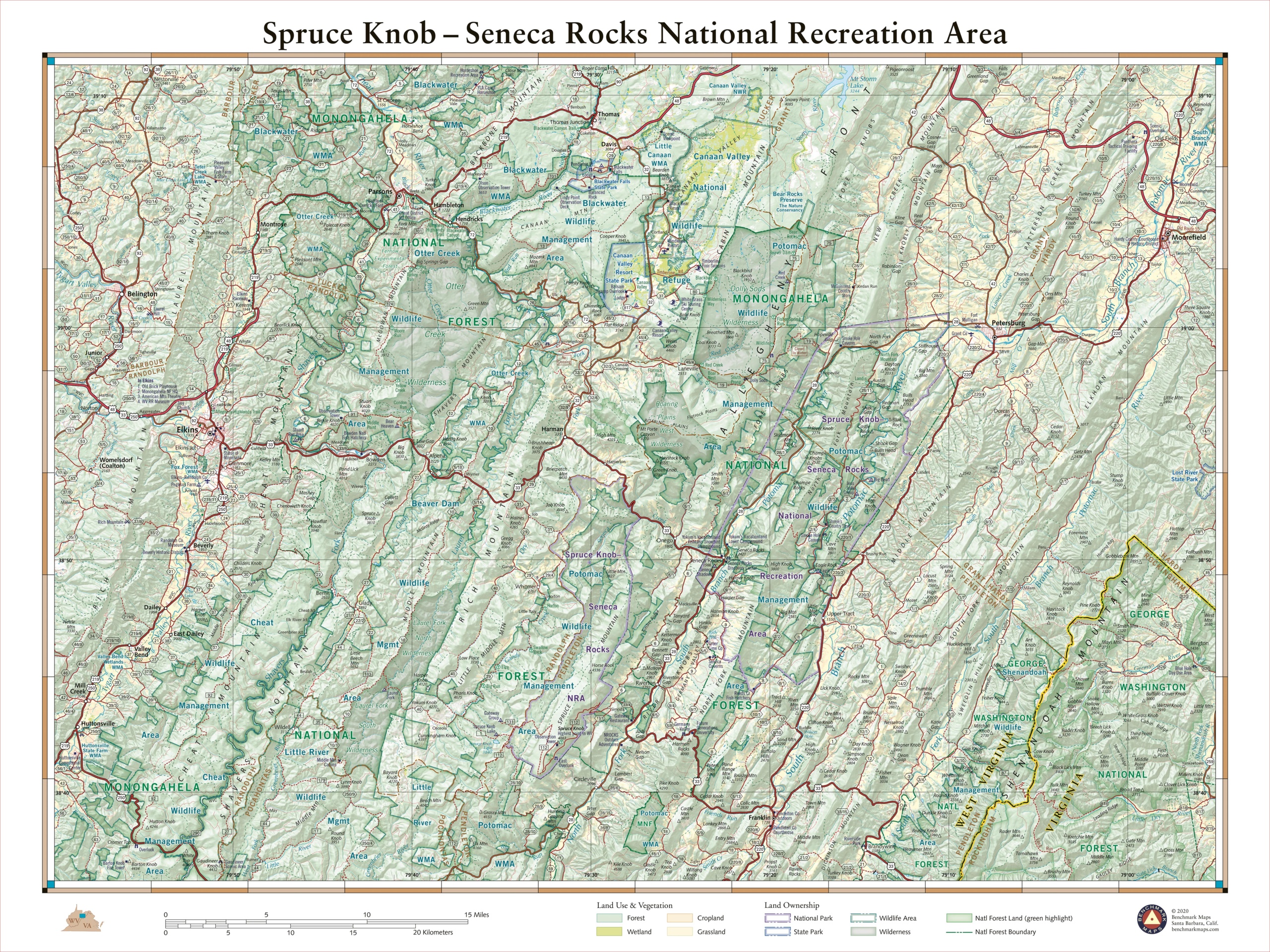
Spruce Knob – Seneca Rocks NRA
—
by
This 40″ x 30″ wall map illustrates some of West Virginia’s best public lands and recreation sites. Spruce Knob is the state’s highest point at 4,863 ft., and Seneca Rocks features some of the best rock climbing in the eastern U.S. This map also highlights recreation access in the surrounding Monongahela National Forest, several wildlife…
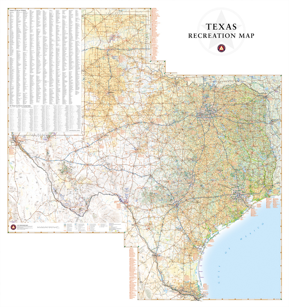
Texas Recreation Wall Map
—
by
This wall map is made by combining our folded Eastern Texas Recreation Map with our Western Texas Recreation Map. It highlights road & recreation information including public lands, parks & monuments, boating & fishing access, hunting unit boundaries, campgrounds, historic sites, point-to-point distances, and more. Dimensions: 28″ w x 30″ h
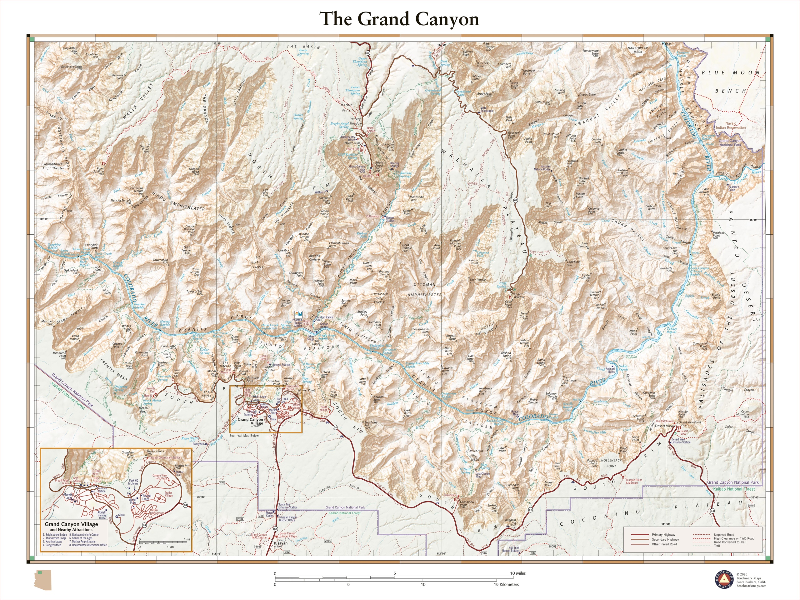
The Grand Canyon
—
by
This 40″ x 30″ wall map details the heart of The Grand Canyon in northern Arizona. Map highlights include the canyon’s myriad geologic features, drainage detail for the many springs and tributaries that feed into the Colorado River, and man-made features such as trails, campgrounds, and river crossings. Each wall map is individually printed on…
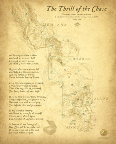
Thrill of the Chase Wall Map
—
by
This wall map illustrates the searchable area for Forrest Fenn’s famous treasure chest. Our map first appeared as a fold-out in Forrest’s 2013 memoir Too Far To Walk. In recent years it was modified with his help into this product for wall display. His treasure was found in the spring of 2020 at an…
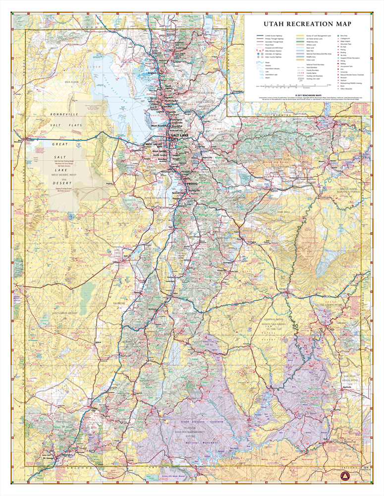
Utah Recreation Wall Map
—
by
This wall map is made from our folded Utah Recreation Map but with a slightly larger sheet size for prominence on your wall. It highlights road & recreation information including public lands, parks & monuments, boating & fishing access, hunting unit boundaries, campgrounds, historic sites, point-to-point distances, and more. Each map is individually printed…
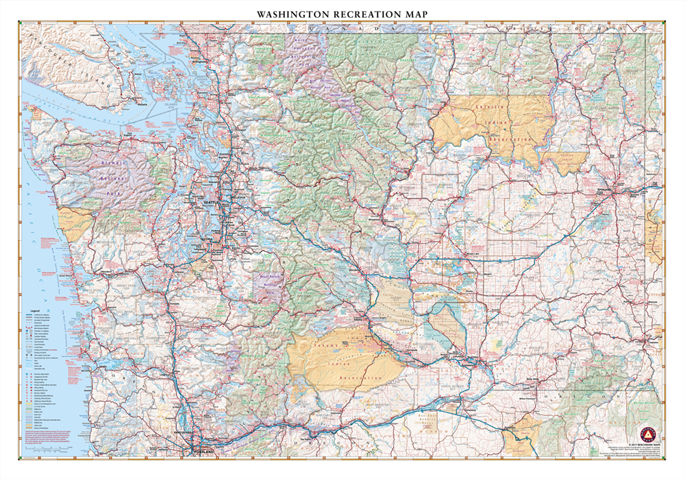
Washington Recreation Wall Map
—
by
This wall map highlights Washington’s highways, state roads, and recreation opportunities including public lands, parks & monuments, boating & fishing access, hunting unit boundaries, campgrounds, historic sites, and more. Dimensions: 37″ w x 26″ h
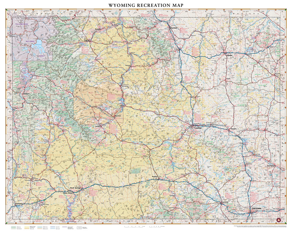
Wyoming Recreation Wall Map
—
by
This wall map is made from our folded Wyoming Recreation Map but with a slightly larger sheet size for prominence on your wall. It highlights road & recreation information including public lands, parks & monuments, boating & fishing access, hunting unit boundaries, campgrounds, historic sites, point-to-point distances, and more. Each map is individually printed on…