Shipping class: Wall Maps
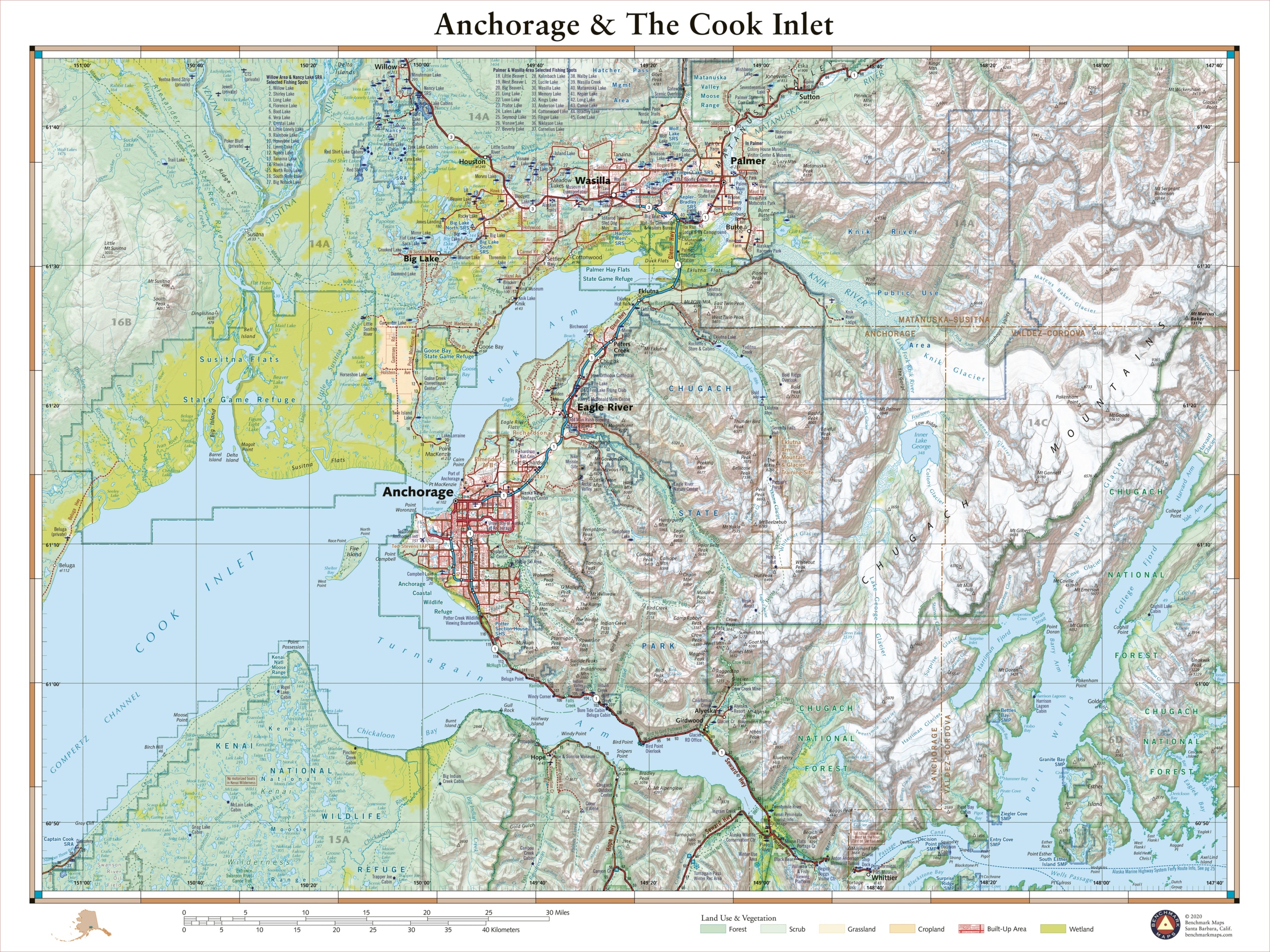
Anchorage & The Cook Inlet
—
by
This 40″ x 30″ wall map details the terrain in Alaska’s most populated area. Coverage includes Anchorage, Palmer, Wasilla, the Knik & Turnagain Arms of Cook Inlet, peaks and glaciers of the Chugach Mountains, the fjords of Port Wells and the western reaches of Prince William Sound. Each wall map is individually printed on…
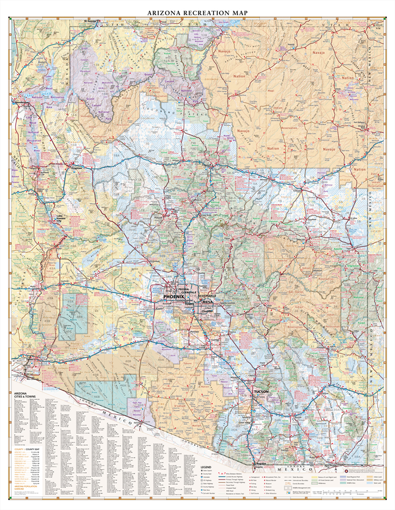
Arizona Recreation Wall Map
—
by
This wall map highlights Arizona’s road networks and recreation opportunities including parks & monuments, boating & fishing access, hunting unit boundaries, campgrounds, historic sites, and more. Dimensions: 33″ w x 26″ h
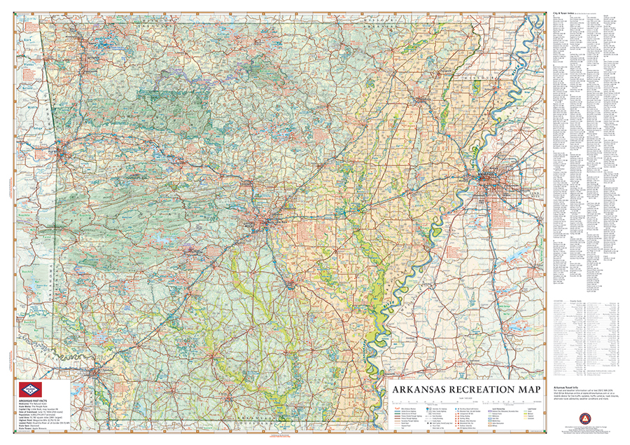
Arkansas Recreation Wall Map
—
by
From the Ozarks & Ouachita Mountains to the densely forested Timberlands to the Delta Lowlands, Arkansas contains a wealth of diverse terrain, wildlife, and public recreation opportunities. This wall map highlights Arkansas’s vast network of highways and byways. It features public land access, state parks, extensive road detail, point-to-point mileages, recreation attractions, campgrounds, parks…
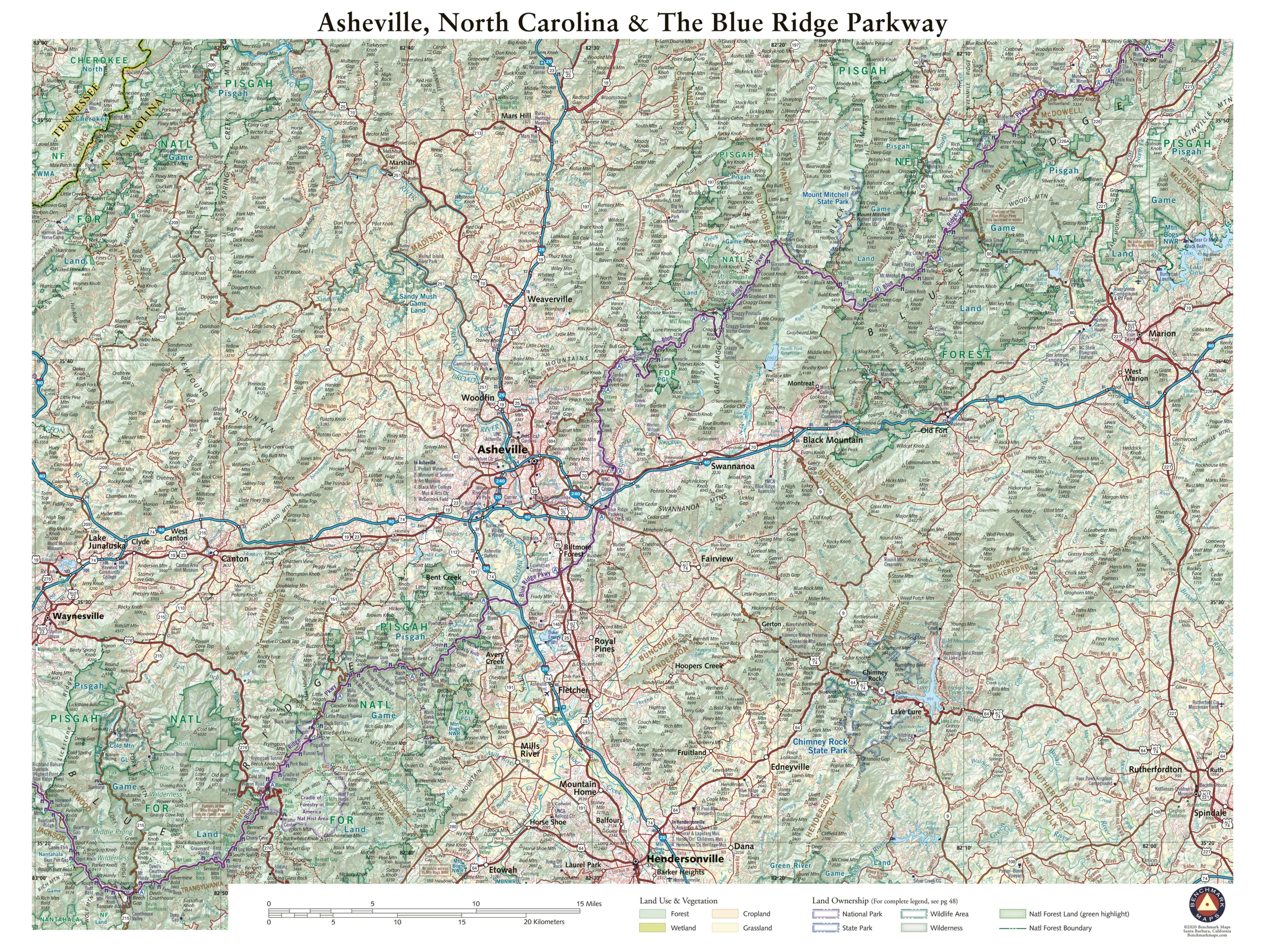
Asheville NC & The Blue Ridge Parkway
—
by
This 40″ x 30″ map details the terrain and public lands surrounding Asheville, North Carolina. Map features include Mt. Mitchell (highest peak in the eastern U.S.), sections of Pisgah National Forest, several of North Carolina’s state parks, and the segment of the Blue Ridge Parkway between McKinney Gap in the northeast and Richland Balsam Overlook…
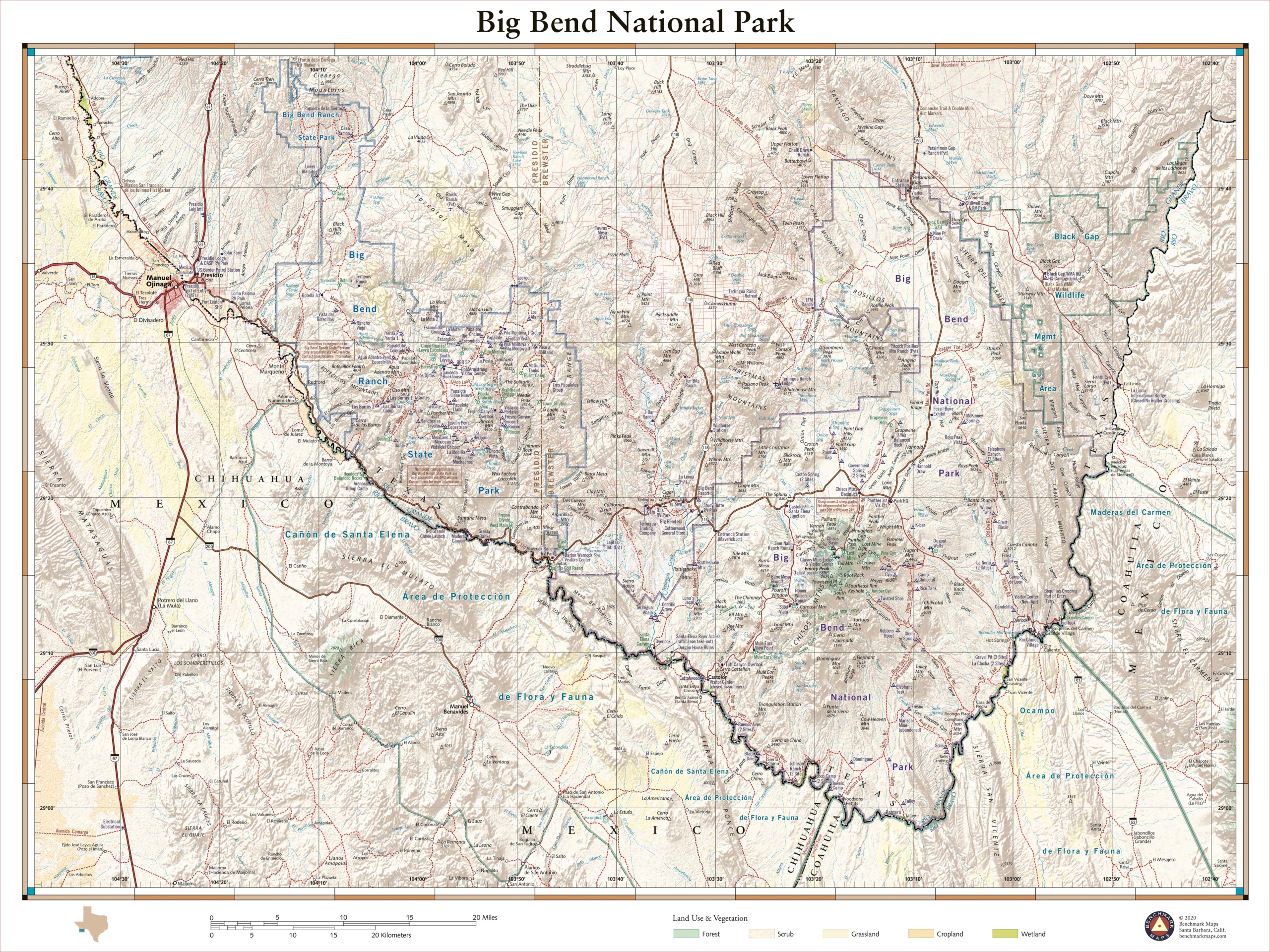
Big Bend National Park
—
by
Remote, expansive, and diverse, Big Bend is a tapestry of West Texas landscapes, where the Chisos Mountains reach skyward over the Chihuahuan Desert and the Rio Grande cuts ever deeper into canyons as it rounds the great curve that gives the park its name. The 1,200 square miles of land protected within the park’s boundaries…
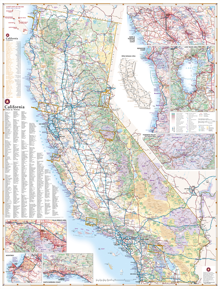
California Recreation Wall Map
—
by
This wall map highlights California’s extensive highway system and public lands. Inset maps for Napa & Sonoma, Redwood Coast, Lake Tahoe, Yosemite Valley, Palm Springs, Monterey, and the Santa Barbara coast. Dimensions: 28″ w x 37″ h
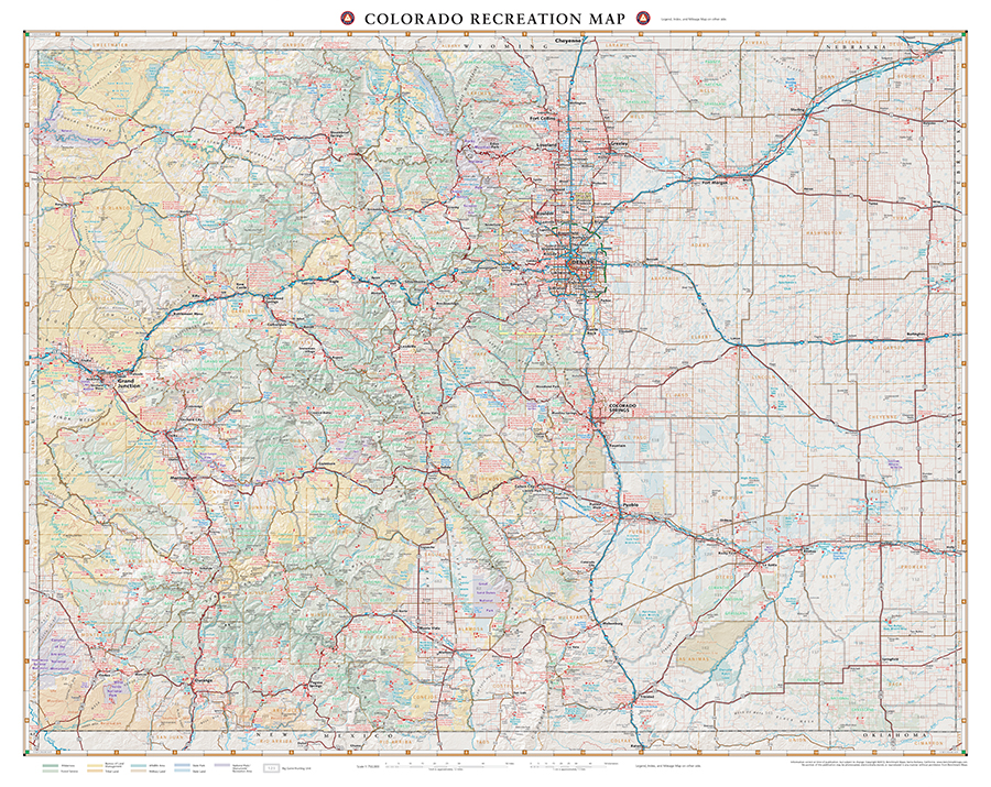
Colorado Recreation Wall Map
—
by
This wall map highlights Colorado’s vast network of roads & recreation attractions including public lands, parks & monuments, boating & fishing access, hunting unit boundaries, campgrounds, historic sites, and more. Dimensions: 33″ w 26″ h
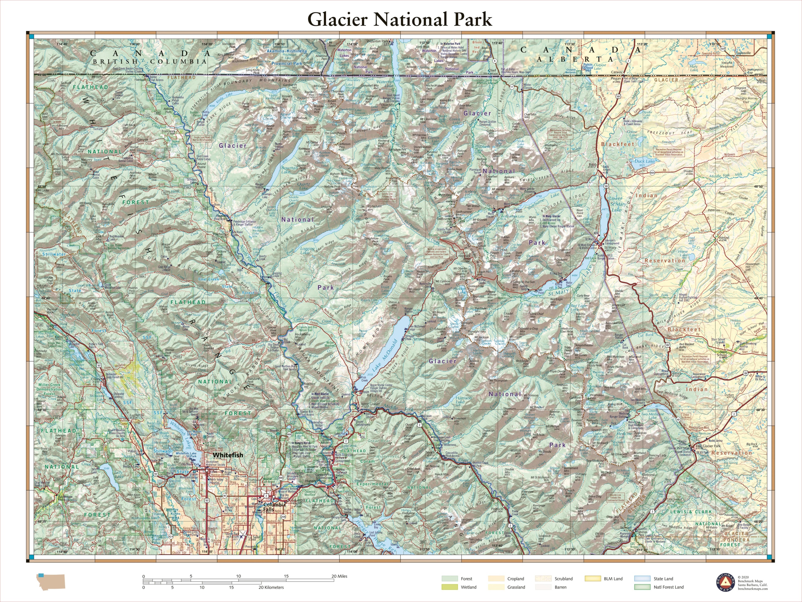
Glacier National Park
—
by
This 40″ x 30″ wall map details the rugged landscapes of Glacier National Park, the crown jewel of Montana’s Rocky Mountains. Map features include public land ownership, recreation points of interest, campgrounds, peak and river names, and the network of highways and back roads that provide access to this stunning mountainous region at the U.S.…
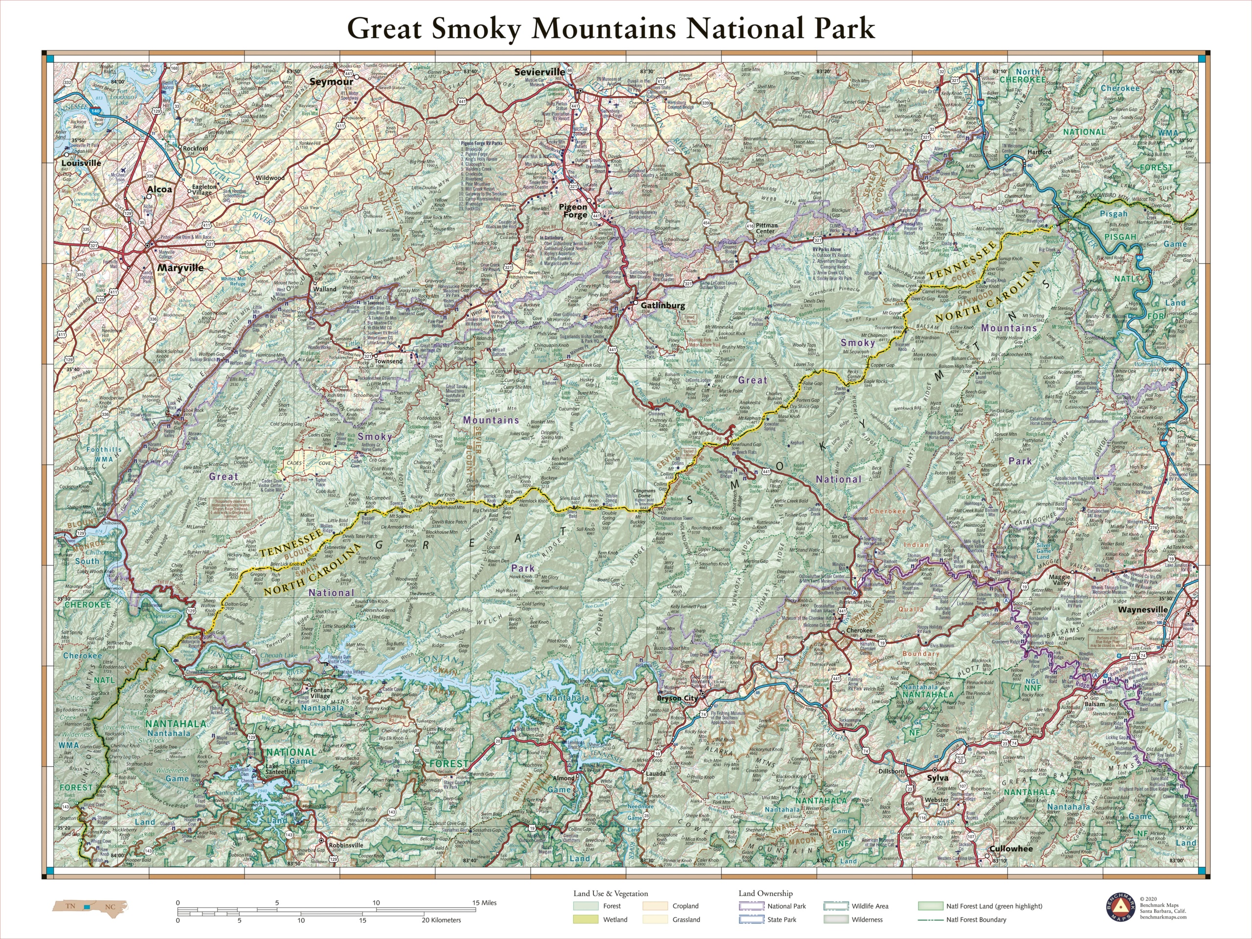
Great Smoky Mountains National Park
—
by
The rugged mountains that straddle the Tennessee – North Carolina border are home to a staggering array of biodiversity and a wealth of historic structures. The Smokies include some of the loftiest peaks in the eastern US and comprise the highest elevations found along the Appalachian Trail. More than 800 miles of trail wind through…
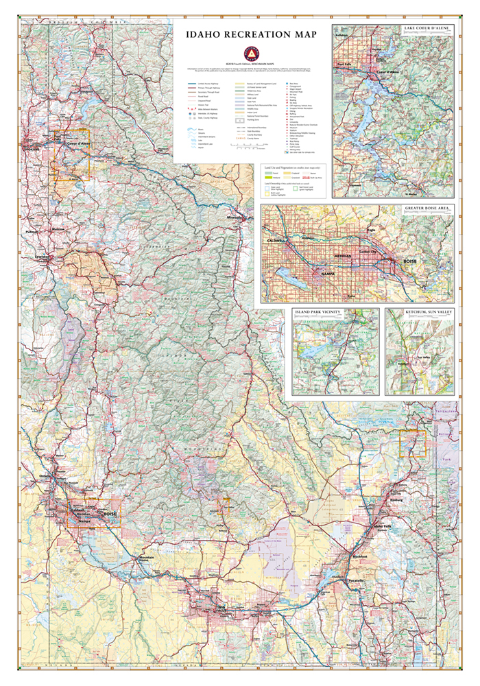
Idaho Recreation Wall Map
—
by
This wall map highlights Idaho’s public lands, parks & monuments, boating & fishing access, hunting unit boundaries, campgrounds, historic sites, and more. Dimensions: 26″ w x 37″ h
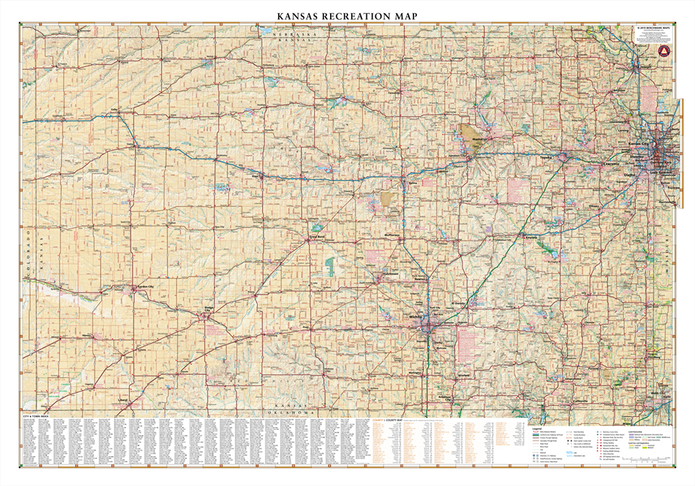
Kansas Recreation Wall Map
—
by
This wall map highlights the road networks and recreation opportunities of Kansas including public lands, parks & monuments, boating & fishing access, hunting unit boundaries, campgrounds, historic sites, point-to-point distances, and more. Dimensions: 37″ w x 26″ h
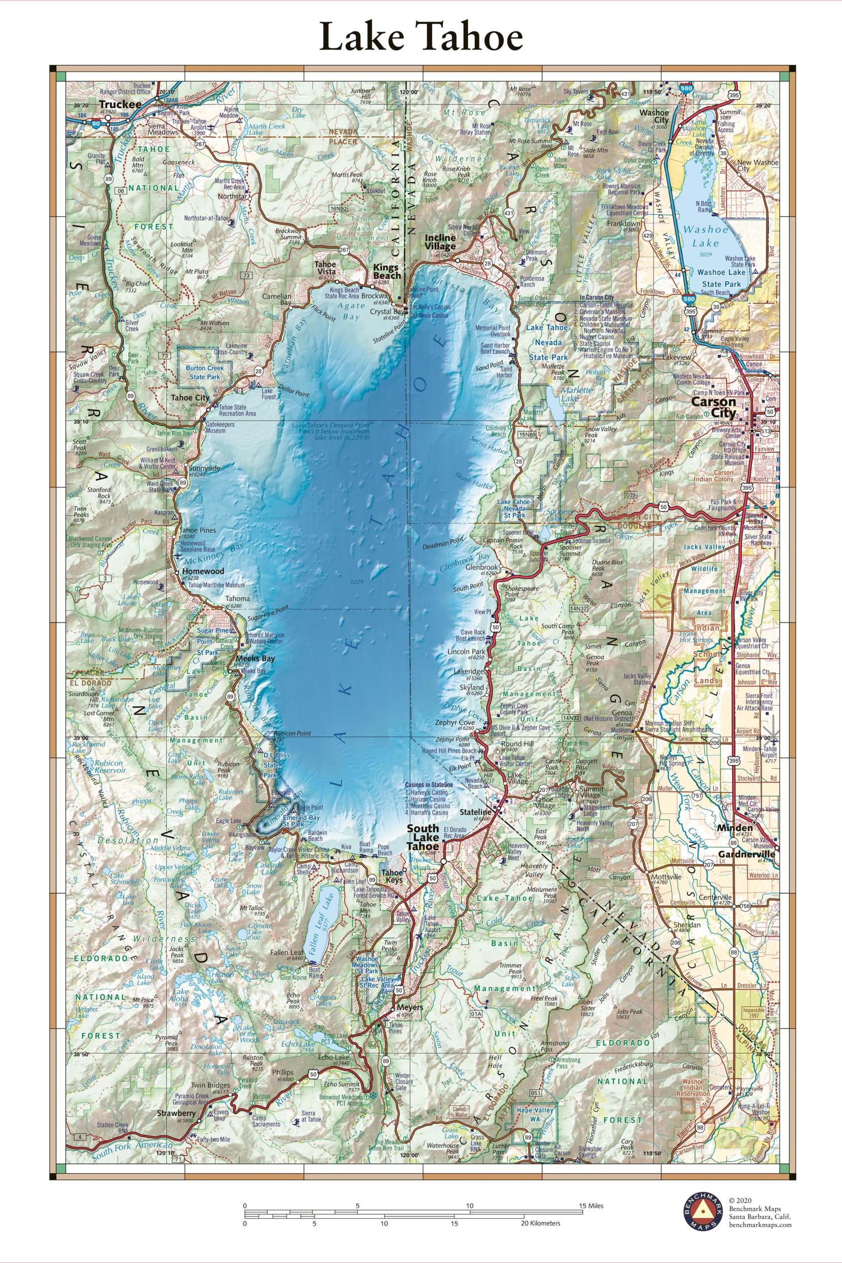
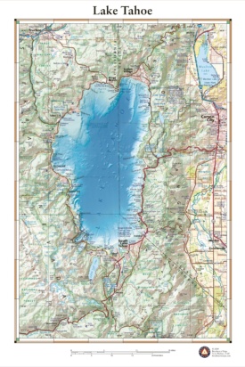
Lake Tahoe
—
by
This 30″ x 40″ wall map illustrates Lake Tahoe, one of the largest and deepest lakes in North America. The surrounding peaks of the Sierra Nevada Mountains, shared by California and Nevada, contain a wealth of recreation opportunities and some of America’s most scenic drives. Map highlights include bathymetric shading of the lake floor, public…
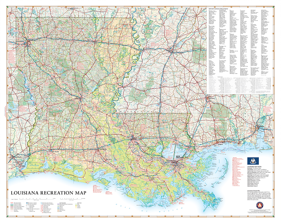
Louisiana Recreation Wall Map
—
by
This new wall map highlights Louisiana’s vast road network and wealth of recreation opportunities, from the northern Piney Hills to the brackish swamps of the Atchafalaya Basin. Features include public lands, parks & monuments, historic sites, boating & fishing access, hunting areas, campgrounds, point-to-point distances, and more. Dimensions: 33″ w x 26″ h …
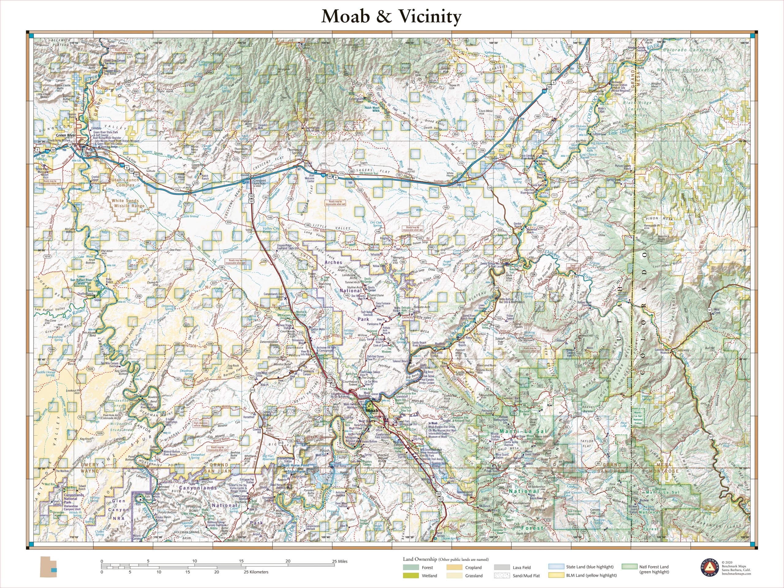
Moab, Utah
—
by
The town of Moab in southeastern Utah sits between Arches National Park and Canyonlands National Park, each with world-class recreation opportunities thanks to the other-worldly desert landscapes and geologic features throughout the area. This 40″ x 30″ wall map details the terrain, public land ownership, and recreation features throughout the area. Each wall map is…
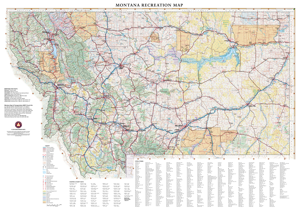
Montana Recreation Wall Map
—
by
This wall map highlights Montana’s network of highways, public lands, parks & monuments, boating & fishing access, hunting unit boundaries, campgrounds, historic sites, and more. Dimensions: 36″ w x 26″ h
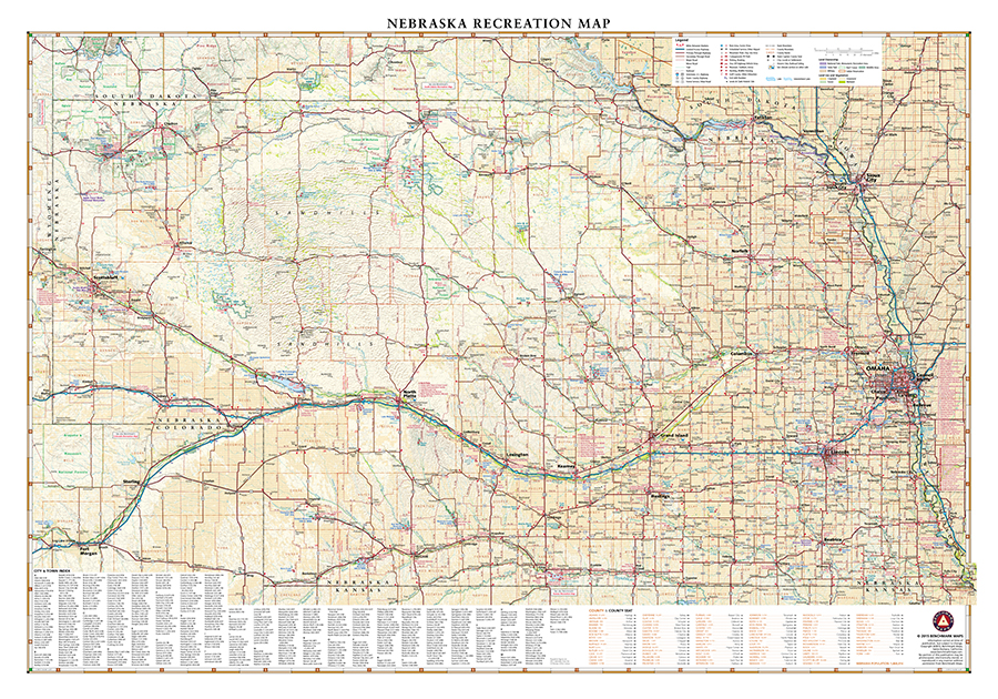
Nebraska Recreation Wall Map
—
by
This wall map highlights Nebraska’s road & recreation opportunities including public lands, parks & monuments, boating & fishing access, hunting unit boundaries, campgrounds, historic sites, point-to-point distances, and more. Dimensions: 37″ w x 26″ h
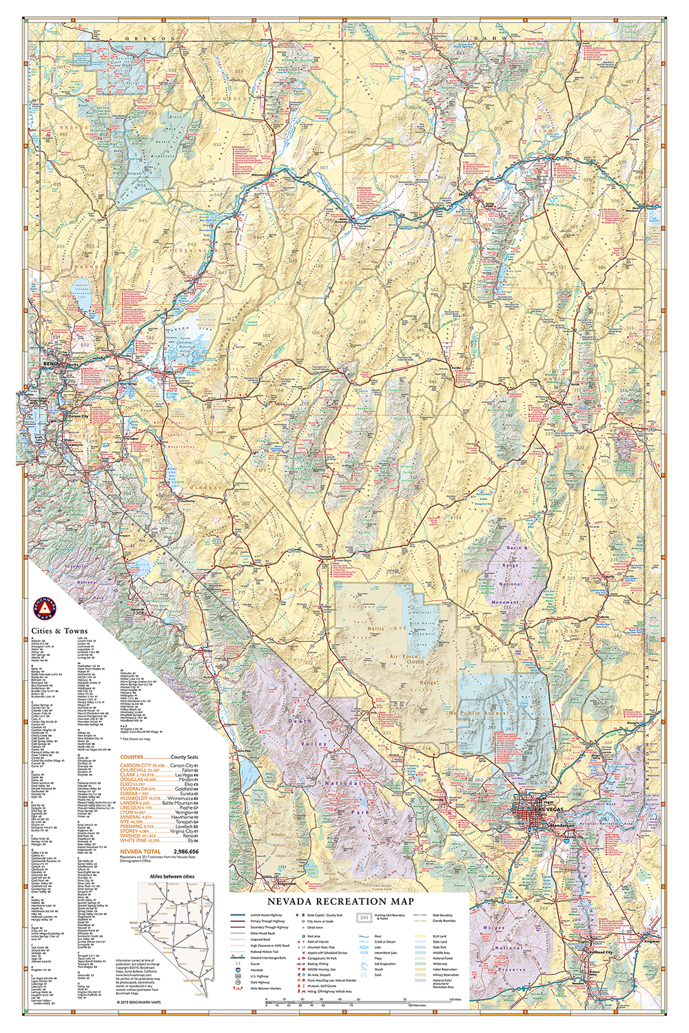
Nevada Recreation Wall Map
—
by
This wall map highlights Nevada’s highways & recreation attractions including public lands, parks & monuments, boating & fishing access, hunting unit boundaries, campgrounds, historic sites, and more. Dimensions: 26″ w x 38″ h
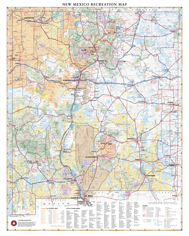
New Mexico Recreation Wall Map
—
by
This wall map highlights New Mexico’s public lands, parks & monuments, boating & fishing access, hunting unit boundaries, campgrounds, historic sites, and more. Dimensions: 26″ w x 33″ h
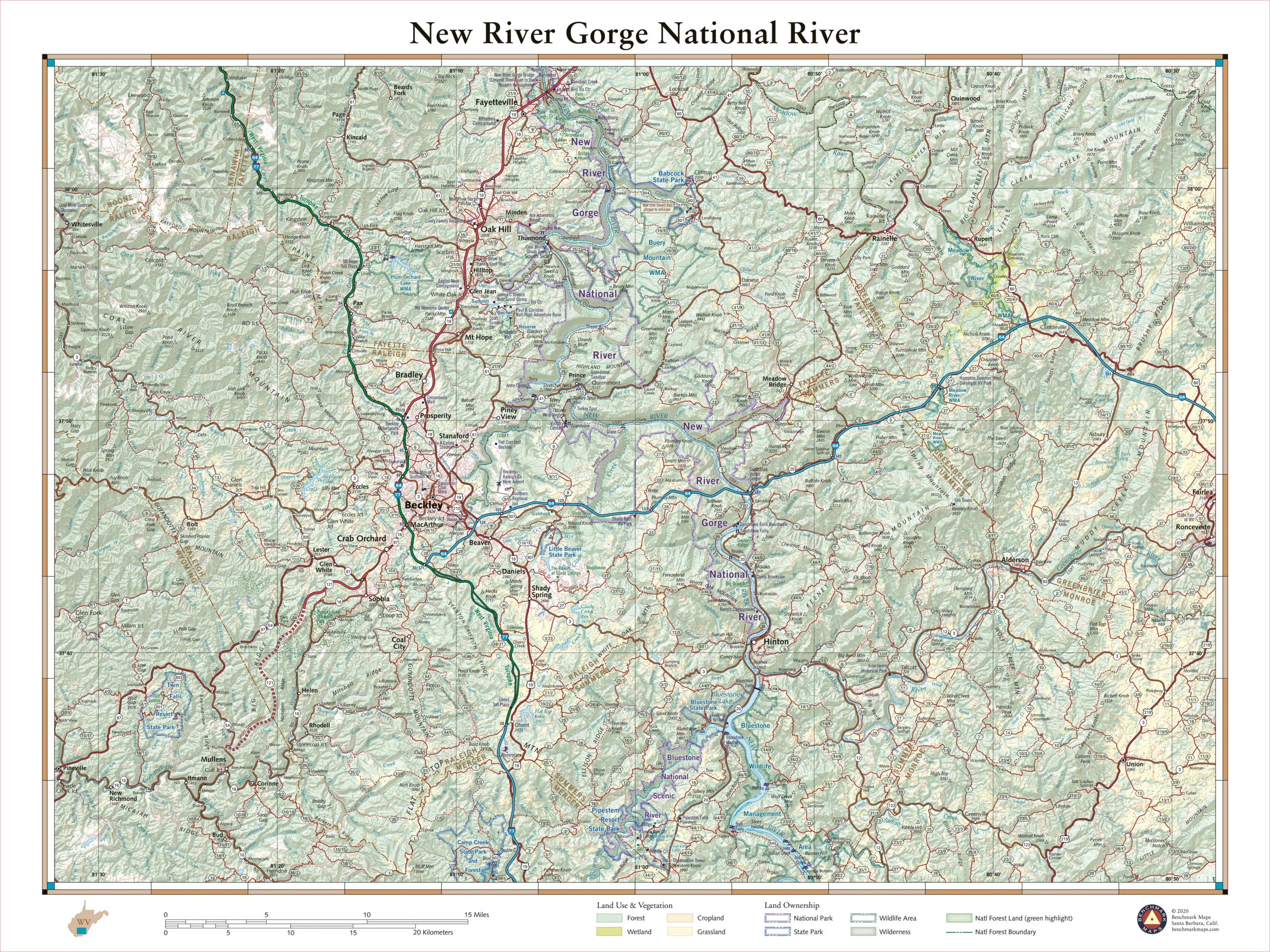
New River Gorge National River
—
by
Contrary to its name, the New River is one of North America’s oldest rivers and has been cutting and carving the gorge to which it lends its title for millions of years. Up to 1,000 feet deep in places, the gorge is a hot spot for rock climbing and whitewater rafting in West Virginia. New…
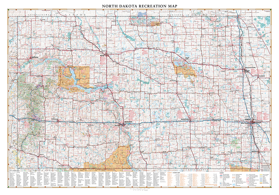
North Dakota Recreation Wall Map
—
by
This wall map highlights North Dakota’s expansive road network and recreation opportunities including public lands, parks & monuments, boating & fishing access, hunting unit boundaries, campgrounds, historic sites, and more. Dimensions: 37″ w x 26″ h
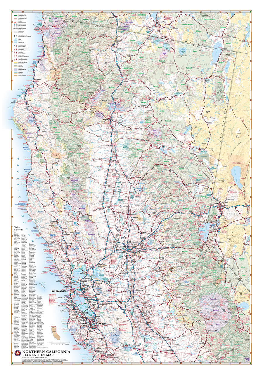
Northern California Recreation Wall Map
—
by
This wall map highlights Northern California’s highway system and extensive public lands, parks & monuments, boating & fishing access, hunting unit boundaries, campgrounds, historic sites, and more. Dimensions: 26″ w x 37″ h
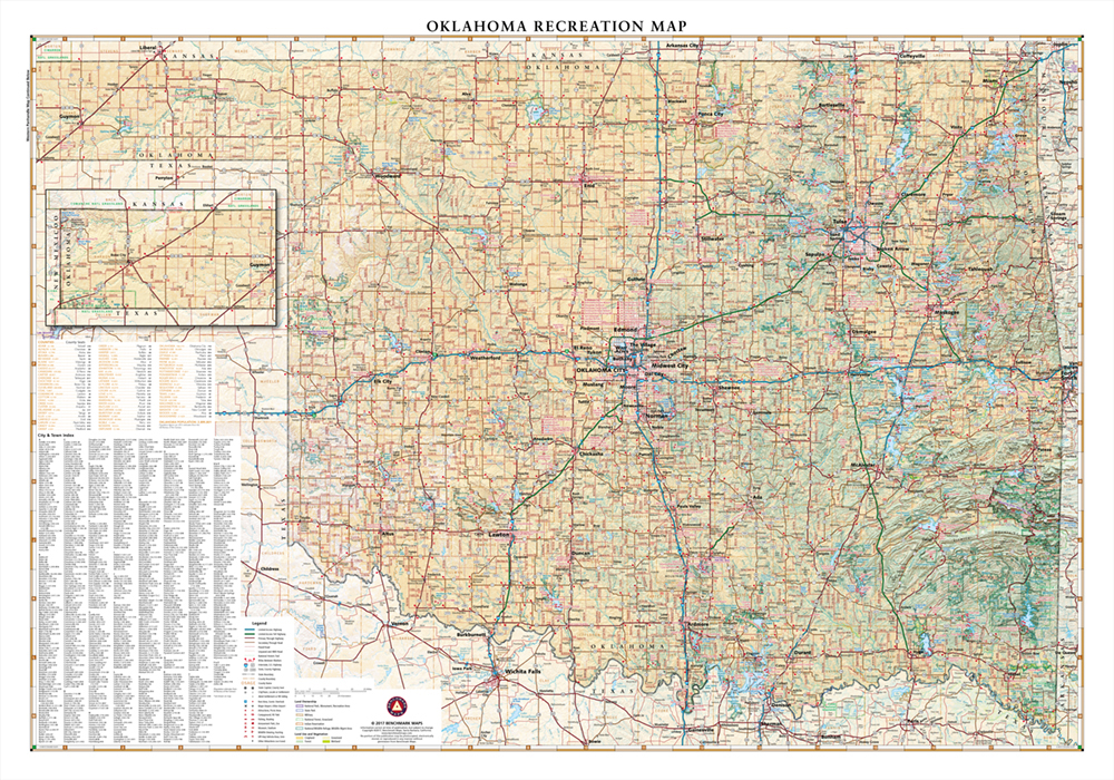
Oklahoma Recreation Wall Map
—
by
This wall map highlights Oklahoma’s road network & recreation attractions including public lands, parks & monuments, boating & fishing access, hunting unit boundaries, campgrounds, historic sites, and more. Dimensions: 37″ w x 26″ h
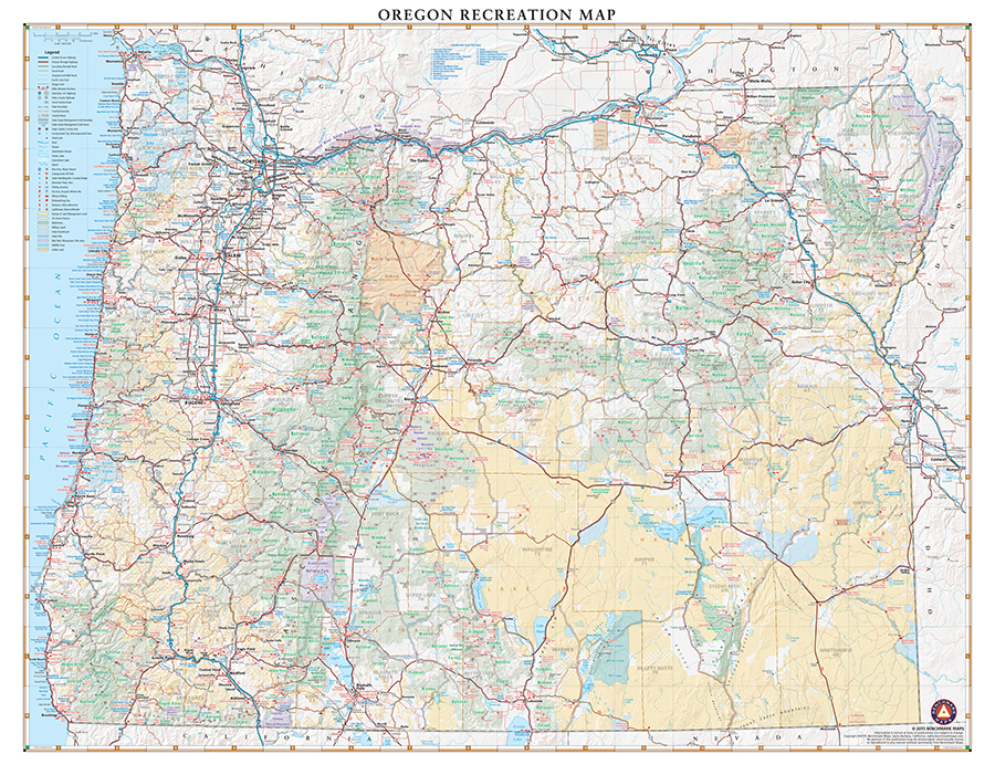
Oregon Recreation Wall Map
—
by
This wall map highlights Oregon’s network of highways and public lands, parks & monuments, boating & fishing access, hunting unit boundaries, campgrounds, historic sites, and more. Dimensions: 33″ w x 26″ h
Print-On-Demand: Atlas Pages as Wall Maps
—
by
Imagine a custom map on your wall, and it’s an enlargement of your favorite Benchmark Maps atlas “page-pair” (adjacent pages that open together). Many customers have called in with these print requests. “Can I get a large print of pages 110-111 from the Colorado atlas?” If they are adjacent pages in the Landscape Maps section…