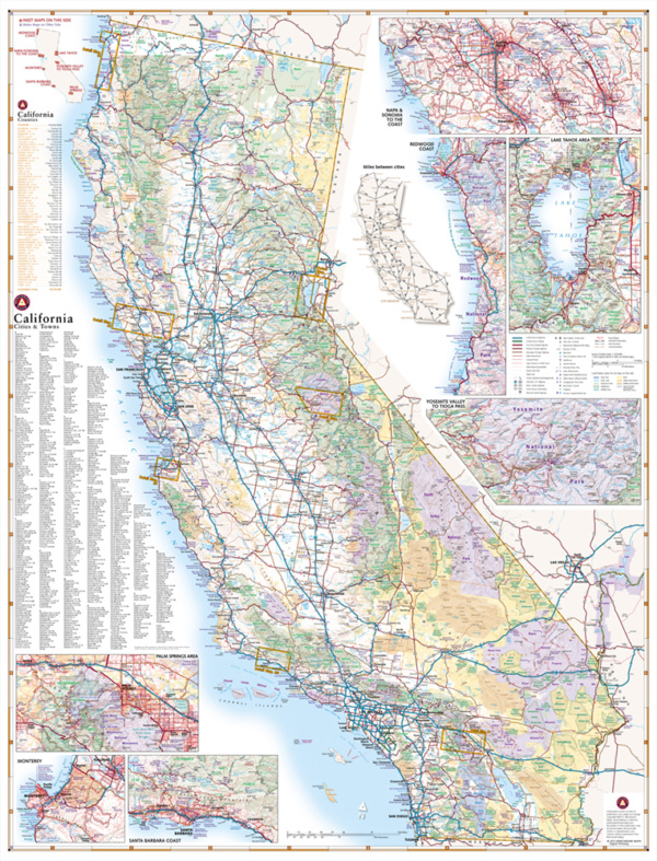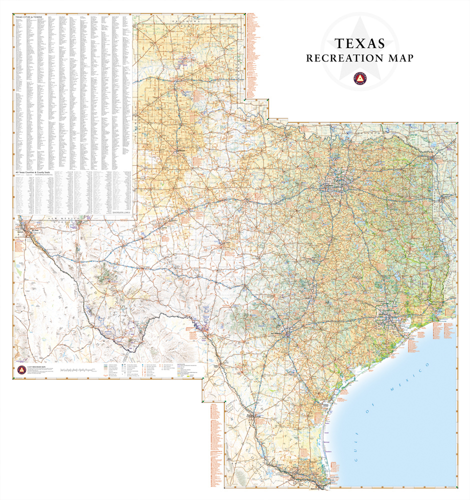
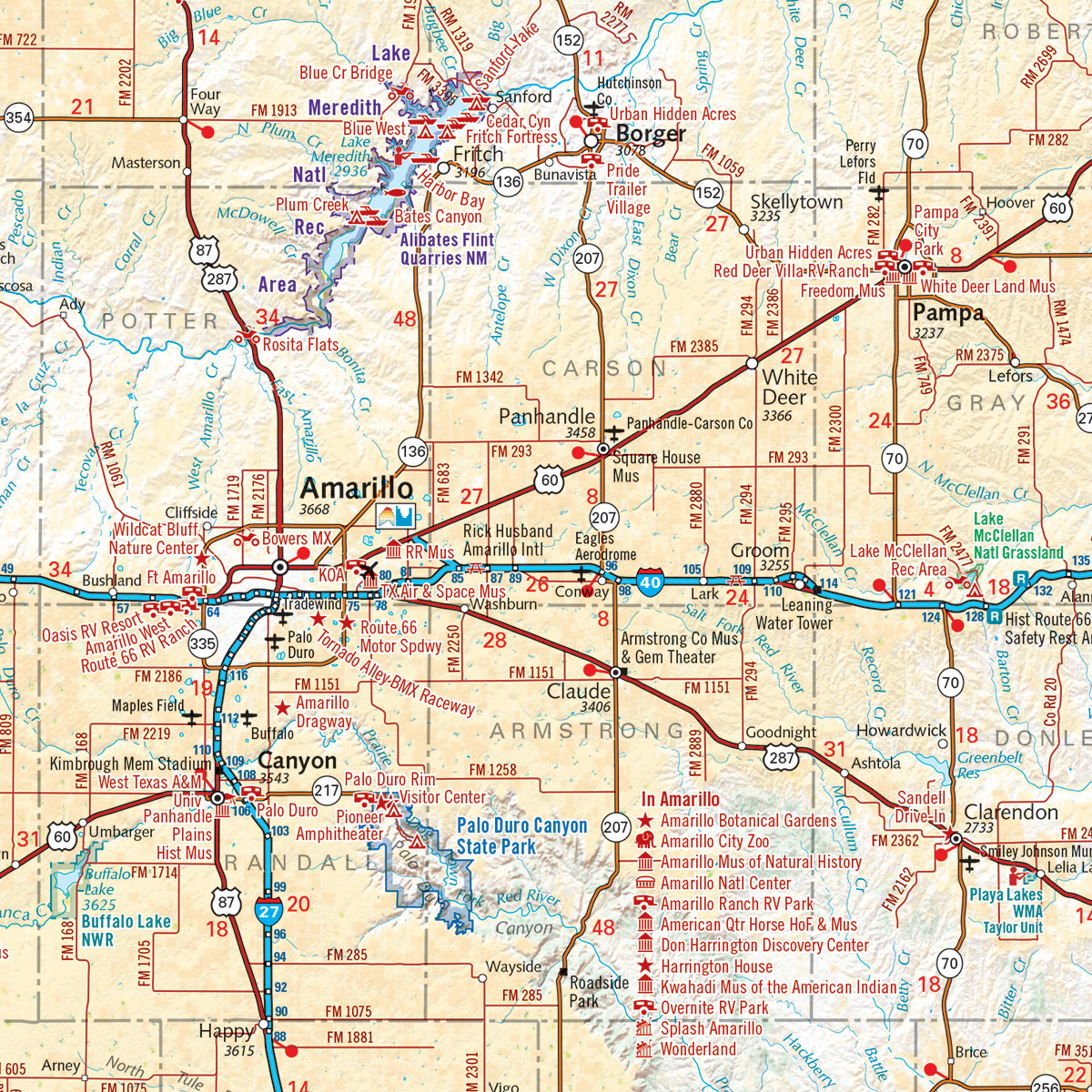
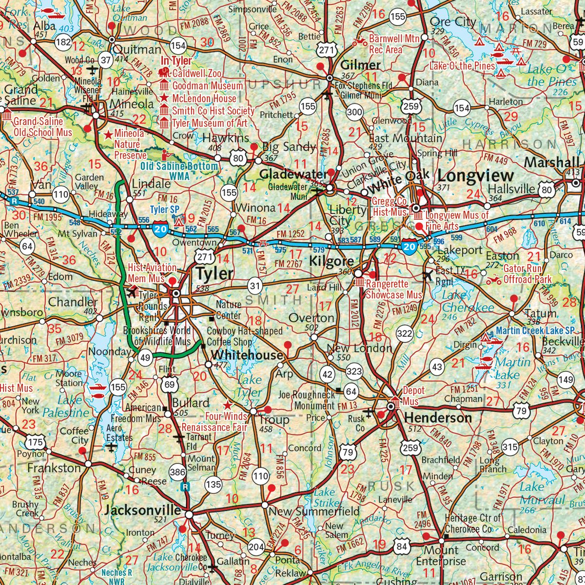
This wall map is made by combining our folded Eastern Texas Recreation Map with our Western Texas Recreation Map. It highlights road & recreation information including public lands, parks & monuments, boating & fishing access, hunting unit boundaries, campgrounds, historic sites, point-to-point distances, and more.
Dimensions: 28″ w x 30″ h