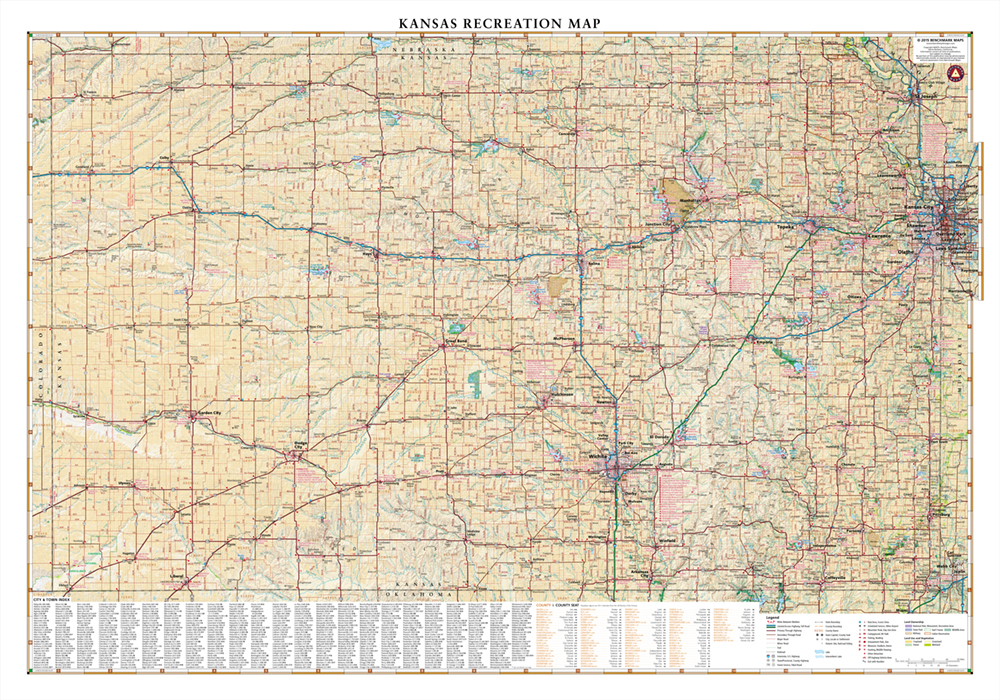
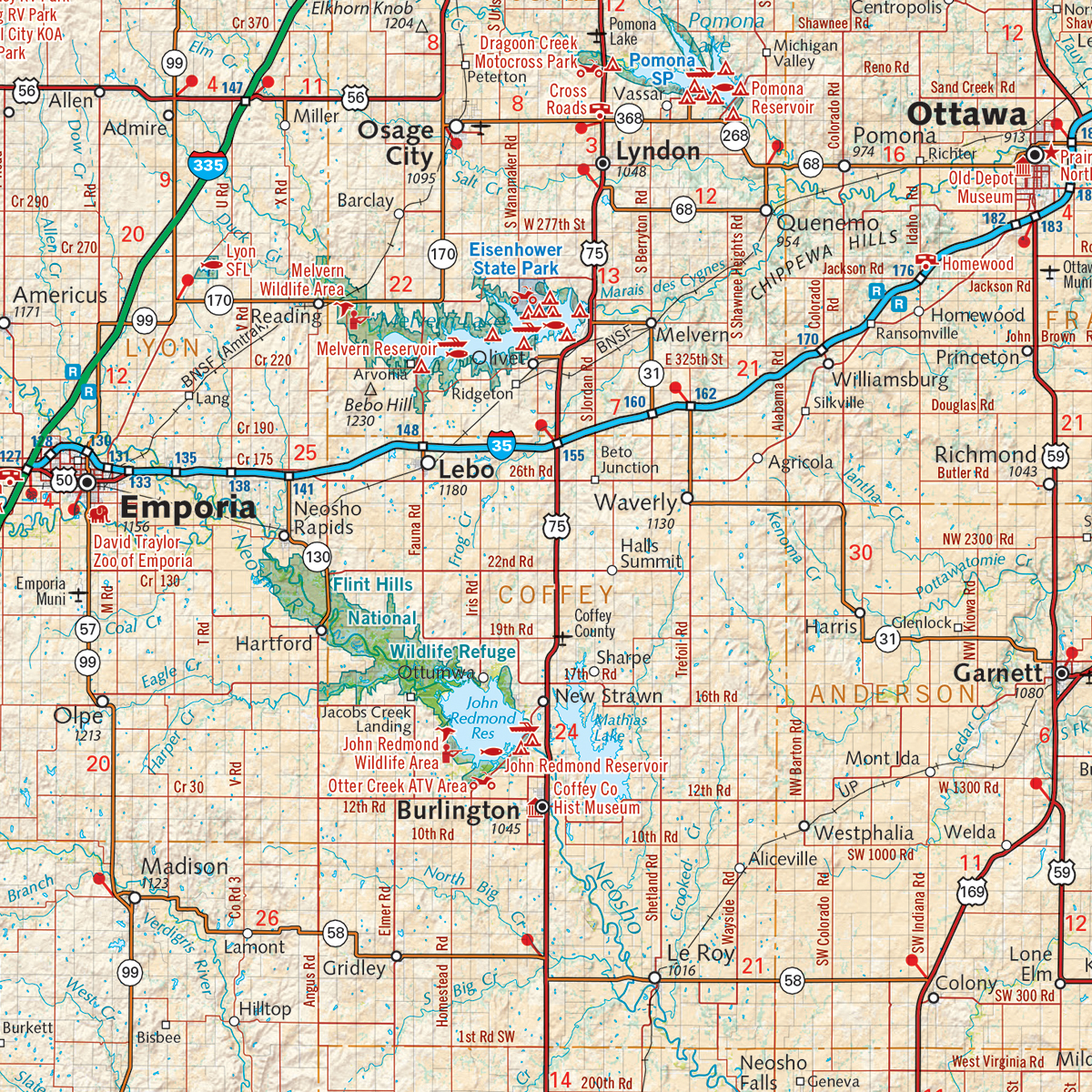
This wall map highlights the road networks and recreation opportunities of Kansas including public lands, parks & monuments, boating & fishing access, hunting unit boundaries, campgrounds, historic sites, point-to-point distances, and more.
Dimensions: 37″ w x 26″ h